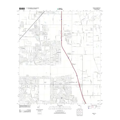
2012 Map of Shady
USGS Topo · Published 2012About this map
Marion Oaks and the surrounding residential developments south of Ocala define this landscape in the early 2010s, illustrating the significant suburban expansion into the Florida interior. The map shows a complex network of planned streets and subdivisions, including Bahia Oaks and the settlement of Shady, interspersed with aviation facilities like Shady International Airport and Mc Ginley Airport.
Find a feature on this map
41 named features on this map. Tap any name to fly to it.
Don’t see what you’re looking for? This feature index may not catch every label — zoom into the map to look around manually.
Map Details
Editions of this 2012 Shady Map
This is the sole edition of this map. No revisions or reprints were ever made.
Other maps of this area

1892 · Dunnellon
USGS Topo · 1:62,500

1893 · Panasoffkee
USGS Topo · 1:62,500

1894 · Dunnellon
USGS Topo · 1:62,500

1895 · Tsala Apopka
USGS Topo · 1:62,500

1895 · Panasoffkee
USGS Topo · 1:62,500

1895 · Ocala
USGS Topo · 1:62,500

1954 · Tsala Apopka NE
USGS Topo · 1:24,000

1954 · Cotton Plant
USGS Topo · 1:24,000

1954 · Dunnellon SE
USGS Topo · 1:24,000

1954 · Inverness
USGS Topo · 1:62,500