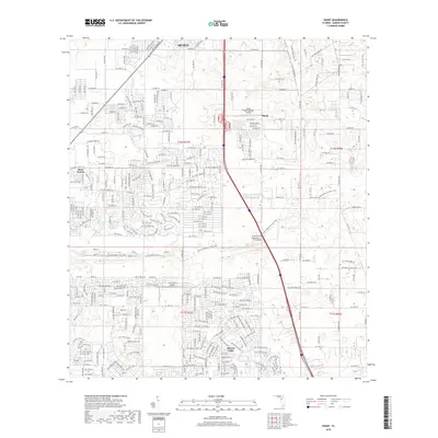
2018 Map of Shady
USGS Topo · Published 2018About this map
Ocala extends its southern suburban reach into this Marion County landscape, where residential development and aviation infrastructure meet the preserved corridor of the Cross Florida Greenway - I-75 Overpass. The settlement of Marion Oaks defines the southern portion of the sheet, characterized by a dense grid of residential streets like SW 144th State Rd, illustrating the rapid expansion of planned communities in central Florida during the early 21st century. To the west, the natural terrain of Ross Prairie provides a stark contrast to the surrounding development. The area's local aviation history is well-represented by both the Shady International Airport near the community of Shady and the McGinley Airport further south, highlighting the importance of private and regional flight in this part of the state.
Find a feature on this map
114 named features on this map. Tap any name to fly to it.
Don’t see what you’re looking for? This feature index may not catch every label — zoom into the map to look around manually.
Map Details
Editions of this 2018 Shady Map
This is the sole edition of this map. No revisions or reprints were ever made.
Other maps of this area

1892 · Dunnellon
USGS Topo · 1:62,500

1893 · Panasoffkee
USGS Topo · 1:62,500

1894 · Dunnellon
USGS Topo · 1:62,500

1895 · Tsala Apopka
USGS Topo · 1:62,500

1895 · Panasoffkee
USGS Topo · 1:62,500

1895 · Ocala
USGS Topo · 1:62,500

1954 · Tsala Apopka NE
USGS Topo · 1:24,000

1954 · Cotton Plant
USGS Topo · 1:24,000

1954 · Dunnellon SE
USGS Topo · 1:24,000

1954 · Inverness
USGS Topo · 1:62,500