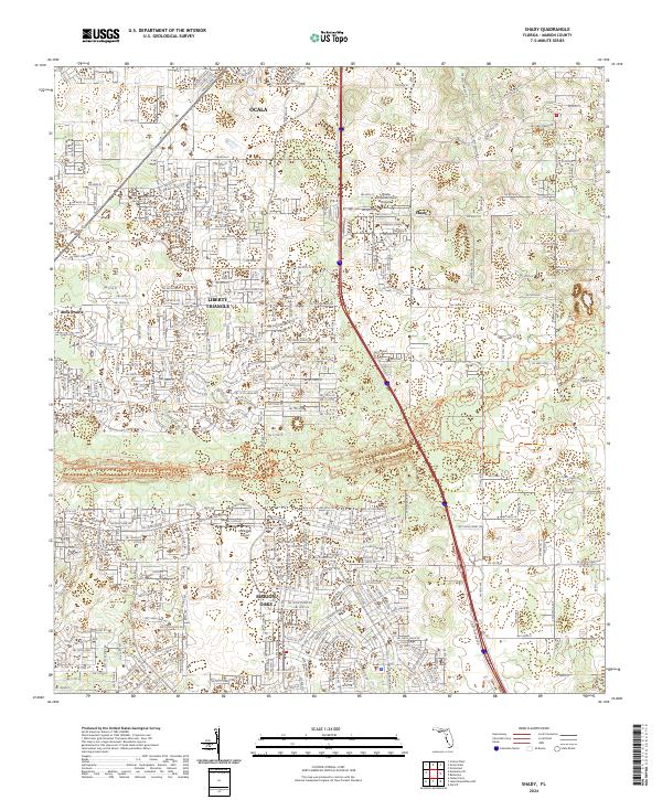
2024 Map of Shady
USGS Topo · Published 2024About this map
Ocala's southern suburban expansion into the Central Florida ridge is prominently displayed in this modern topographic survey. The landscape is defined by the significant corridor of the Cross Florida Greenway, which traverses the center of the map alongside the Florida National Scenic Trl. This protected corridor preserves a swath of natural terrain amidst the growing residential footprints of Marion Oaks and the Liberty Triangle. The map captures the specialized aviation character of the region with both Shady International Airport and McGinley Airport serving the area. To the west, the open expanse of Ross Prairie provides a sharp contrast to the dense network of contemporary road developments like SW 80th St and SW College Rd that characterize the contemporary settlement pattern of southern Marion County.
Find a feature on this map
110 named features on this map. Tap any name to fly to it.
Don’t see what you’re looking for? This feature index may not catch every label — zoom into the map to look around manually.
Map Details
Editions of this 2024 Shady Map
This is the sole edition of this map. No revisions or reprints were ever made.
Other maps of this area

1892 · Dunnellon
USGS Topo · 1:62,500

1893 · Panasoffkee
USGS Topo · 1:62,500

1894 · Dunnellon
USGS Topo · 1:62,500

1895 · Tsala Apopka
USGS Topo · 1:62,500

1895 · Panasoffkee
USGS Topo · 1:62,500

1895 · Ocala
USGS Topo · 1:62,500

1954 · Tsala Apopka NE
USGS Topo · 1:24,000

1954 · Cotton Plant
USGS Topo · 1:24,000

1954 · Dunnellon SE
USGS Topo · 1:24,000

1954 · Inverness
USGS Topo · 1:62,500