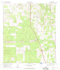
1968 Map of Shady
USGS Topo · Published 1970About this map
Shady and Martel anchor this central Florida landscape during a period of significant infrastructure planning. The most striking feature is the corridor for the Proposed Cross Florida Barge Canal, which cuts a wide horizontal swath across the terrain just south of the township line between T. 16 S. and T. 17 S. This massive public works project, intended to link the Atlantic and the Gulf, appears here alongside existing local landmarks like the Lookout Tower and several Landing Strips.
Find a feature on this map
16 named features on this map. Tap any name to fly to it.
Don’t see what you’re looking for? This feature index may not catch every label — zoom into the map to look around manually.
Map Details
Editions of this 1968 Shady Map
This is the sole edition of this map. No revisions or reprints were ever made.
Other maps of this area

1892 · Dunnellon
USGS Topo · 1:62,500

1893 · Panasoffkee
USGS Topo · 1:62,500

1894 · Dunnellon
USGS Topo · 1:62,500

1895 · Tsala Apopka
USGS Topo · 1:62,500

1895 · Panasoffkee
USGS Topo · 1:62,500

1895 · Ocala
USGS Topo · 1:62,500

1954 · Tsala Apopka NE
USGS Topo · 1:24,000

1954 · Cotton Plant
USGS Topo · 1:24,000

1954 · Dunnellon SE
USGS Topo · 1:24,000

1954 · Inverness
USGS Topo · 1:62,500