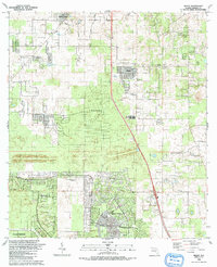
1991 Map of Shady
USGS Topo · Published 1991About this map
Marion Oaks and Florida Highlands anchor the southern portion of this landscape, showcasing the planned residential growth characterizing Marion County in the late 20th century. The central corridor is dominated by the community of Shady, where the Shady Landing Strip and Shady Grove Ch serve as local landmarks alongside a rest area on the main highway. To the north, the terrain transitions into established pockets like Martel and the Bahia Oaks development.
Find a feature on this map
32 named features on this map. Tap any name to fly to it.
Don’t see what you’re looking for? This feature index may not catch every label — zoom into the map to look around manually.
Map Details
Editions of this 1991 Shady Map
This is the sole edition of this map. No revisions or reprints were ever made.
Other maps of this area

1892 · Dunnellon
USGS Topo · 1:62,500

1893 · Panasoffkee
USGS Topo · 1:62,500

1894 · Dunnellon
USGS Topo · 1:62,500

1895 · Tsala Apopka
USGS Topo · 1:62,500

1895 · Panasoffkee
USGS Topo · 1:62,500

1895 · Ocala
USGS Topo · 1:62,500

1954 · Tsala Apopka NE
USGS Topo · 1:24,000

1954 · Cotton Plant
USGS Topo · 1:24,000

1954 · Dunnellon SE
USGS Topo · 1:24,000

1954 · Inverness
USGS Topo · 1:62,500