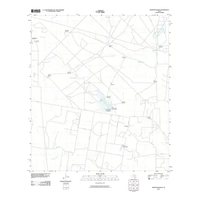
2010 Map of Shaeffer Ranch
USGS Topo · Published 2010About this map
El Carro and the Shaeffer Ranch define this South Texas landscape in the early 21st century, where agricultural life centers around a network of vital water infrastructure. The terrain is marked by numerous windmills, such as Mendiates Windmill, Blanca Windmill, and Yellowtop Windmill, which sustain the ranching operations across the brush country. The presence of the Amargosa Oil Field highlights the area's dual-purpose economy of energy extraction alongside traditional cattle ranching.
Find a feature on this map
37 named features on this map. Tap any name to fly to it.
Don’t see what you’re looking for? This feature index may not catch every label — zoom into the map to look around manually.
Map Details
Editions of this 2010 Shaeffer Ranch Map
This is the sole edition of this map. No revisions or reprints were ever made.
Other maps of this area

1920 · Mikeska
USGS Topo · 1:125,000

1920 · San Diego
USGS Topo · 1:62,500

1953 · Crystal City
USGS Topo · 1:250,000

1955 · Crystal City
USGS Topo · 1:250,000

1956 · Rosita Ranch
USGS Topo · 1:62,500

1956 · Laredo
USGS Topo · 1:250,000

1961 · Crystal City
USGS Topo · 1:250,000
1963 · Anna Rose
USGS Topo · 1:24,000

1963 · San Diego NE
USGS Topo · 1:24,000

1963 · San Diego
USGS Topo · 1:24,000