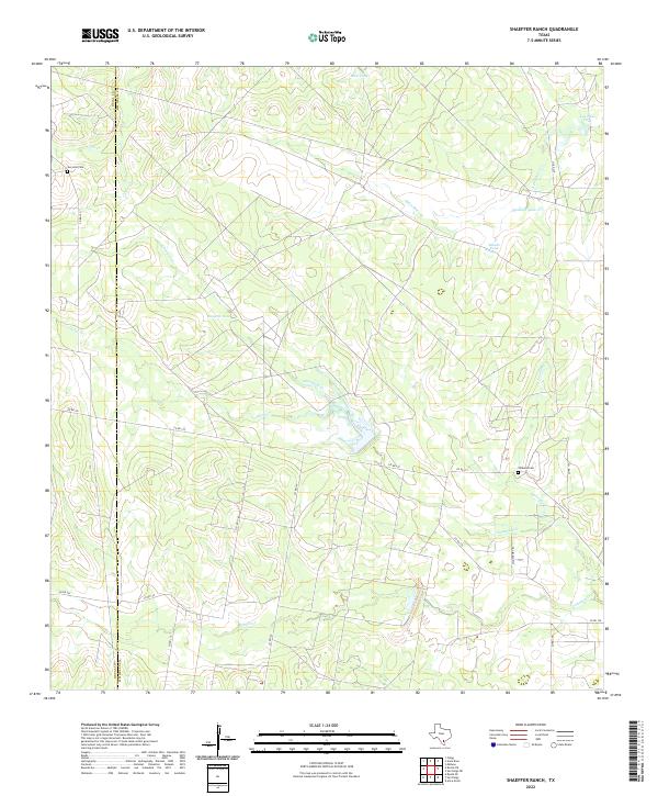
2022 Map of Shaeffer Ranch
USGS Topo · Published 2022About this map
The county line between Duval Co and Jim Wells Co bisects this South Texas landscape, defined by a network of drainage creeks and ranching infrastructure. Arid water management is central to the area's geography, evidenced by named reservoirs such as Romera Tank, Mule Tank, and Javalina Tank. The terrain is drained by several seasonal waterways, most notably Amargosa Creek, Agua Dulce Creek, and Chiltipin Creek, which carve subtle paths through the brush country. Genealogy interests are anchored by small, isolated burial sites like San Jose Cemetery in the northwest and Villareal Cemetery further east. A grid of rural routes, including County Road 145 and the aptly named Nighthawk Trail, provides the primary access to these remote ranch holdings.
Find a feature on this map
25 named features on this map. Tap any name to fly to it.
Don’t see what you’re looking for? This feature index may not catch every label — zoom into the map to look around manually.
Map Details
Editions of this 2022 Shaeffer Ranch Map
This is the sole edition of this map. No revisions or reprints were ever made.
Other maps of this area

1920 · Mikeska
USGS Topo · 1:125,000

1920 · San Diego
USGS Topo · 1:62,500

1953 · Crystal City
USGS Topo · 1:250,000

1955 · Crystal City
USGS Topo · 1:250,000

1956 · Rosita Ranch
USGS Topo · 1:62,500

1956 · Laredo
USGS Topo · 1:250,000

1961 · Crystal City
USGS Topo · 1:250,000
1963 · Anna Rose
USGS Topo · 1:24,000

1963 · San Diego NE
USGS Topo · 1:24,000

1963 · San Diego
USGS Topo · 1:24,000