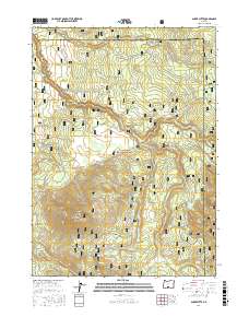
2017 Map of Shake Butte
USGS Topo · Published 2017About this map
The Fremont National Forest dominates this section of the Oregon high country, where the headwaters of the Sycan River wind through a landscape defined by volcanic landmarks and seasonally wet meadows. Elevations rise to the summit of Shake Butte in the western portion of the quadrangle, overlooking the broad expanse of Squaw Flat and Crazyman Flat. The water network is intricate, with drainage from Paradise Cr, Skull Cr, and Shake Cr feeding into the river system. Notable for hunters and outdoorsmen, the 2017 survey details a dense network of forest development roads and the Hadley Snowmobile trail, while naming vital water sources like Driscol Spring and Watson Spring. The transition from the Kingry Marsh to the timbered ridges illustrates the varied ecology at the Lake and Klamath county line.
Find a feature on this map
41 named features on this map. Tap any name to fly to it.
Don’t see what you’re looking for? This feature index may not catch every label — zoom into the map to look around manually.
Map Details
Editions of this 2017 Shake Butte Map
This is the sole edition of this map. No revisions or reprints were ever made.
Other maps of this area

1889 · Klamath
USGS Topo · 1:250,000

1894 · Klamath
USGS Topo · 1:250,000

1955 · Klamath Falls
USGS Topo · 1:250,000

1958 · Klamath Falls
USGS Topo · 1:250,000

1960 · Riverbed Butte
USGS Topo · 1:62,500

1960 · Sycan Marsh
USGS Topo · 1:62,500

1966 · Shake Butte
USGS Topo · 1:24,000

1966 · Sandhill Crossing
USGS Topo · 1:24,000

1966 · Harvey Creek
USGS Topo · 1:24,000

1966 · Fremont Point
USGS Topo · 1:24,000