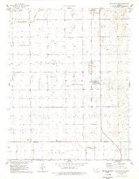
1976 Map of Shallow Water
USGS Topo · Published 1978About this map
The high plains of Western Kansas in the mid-1970s reveal an landscape defined by agriculture and energy extraction along the Atchison Topeka and Santa Fe railroad line. Near the settlement of Shallow Water, industrial activity is prominent with a local Refinery and Industrial Waste Ponds situated adjacent to the tracks. The region's petroleum economy is further evidenced by a sprawling Oil Field and several scattered gas wells.
Find a feature on this map
18 named features on this map. Tap any name to fly to it.
Don’t see what you’re looking for? This feature index may not catch every label — zoom into the map to look around manually.
Map Details
Editions of this 1976 Shallow Water Map
This is the sole edition of this map. No revisions or reprints were ever made.
Other maps of this area

1940 · Scott City
USGS Topo · 1:62,500

1941 · Modoc
USGS Topo · 1:62,500

1944 · Tennis
USGS Topo · 1:62,500

1951 · Scott City
USGS Topo · 1:62,500

1951 · Modoc
USGS Topo · 1:62,500

1955 · Scott City
USGS Topo · 1:250,000

1958 · Scott City
USGS Topo · 1:250,000

1965 · Wolf NE
USGS Topo · 1:24,000
1976 · Modoc SE
USGS Topo · 1:24,000
1976 · Tennis
USGS Topo · 1:24,000