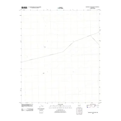
2010 Map of Shannon Canyon NW
USGS Topo · Published 2010About this map
Isolated homesteads like Cain Ranch and Sanchez Ranch define this landscape in the high desert of Sierra County. Situated in a region of vast open terrain and intermittent drainage, these ranches represent the sparse but persistent agricultural presence in central New Mexico during the early 21st century. The map depicts a simple infrastructure network, primarily consisting of County Road A-26 and County Rd A025, which serve as the primary links between these remote holdings. The topographic detail highlights the subtle drainage patterns and canyon systems that characterize the local geography north of the Elephant Butte area.
Find a feature on this map
4 named features on this map. Tap any name to fly to it.
Don’t see what you’re looking for? This feature index may not catch every label — zoom into the map to look around manually.
Map Details
Editions of this 2010 Shannon Canyon NW Map
This is the sole edition of this map. No revisions or reprints were ever made.
Other maps of this area

1916 · Salinas Peak
USGS Topo · 1:125,000

1948 · Sowell
USGS Topo · 1:62,500

1948 · Malpais Well
USGS Topo · 1:62,500

1954 · Tularosa
USGS Topo · 1:250,000

1958 · Tularosa
USGS Topo · 1:250,000

1959 · Engle
USGS Topo · 1:62,500

1961 · Crocker
USGS Topo · 1:24,000

1979 · Truth or Consequences
USGS Topo · 1:100,000
1981 · Shannon Canyon
USGS Topo · 1:24,000
1981 · Polecat Tank
USGS Topo · 1:24,000