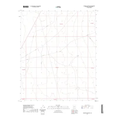
2023 Map of Shannon Canyon NW
USGS Topo · Published 2023About this map
The high desert landscape of Sierra County is defined by a network of ranching infrastructure and rural corridors in this contemporary survey. Remote water sources like Sevenmile Tank and S C S Tank provide essential points of orientation in a region dominated by the Public Land Survey System's township and range grid, spanning areas like t13s r1w and t12s r1w. The map documents a sparse but vital transport network, including Co Rd A-26 and J Cain Rd, which facilitate movement across the arid terrain. Names such as Russel Cain reflect the long-standing familial and individual ties to the land, offering a modern look at the continued occupation and management of these expansive Western New Mexico reaches.
Find a feature on this map
15 named features on this map. Tap any name to fly to it.
Don’t see what you’re looking for? This feature index may not catch every label — zoom into the map to look around manually.
Map Details
Editions of this 2023 Shannon Canyon NW Map
This is the sole edition of this map. No revisions or reprints were ever made.
Other maps of this area

1916 · Salinas Peak
USGS Topo · 1:125,000

1948 · Sowell
USGS Topo · 1:62,500

1948 · Malpais Well
USGS Topo · 1:62,500

1954 · Tularosa
USGS Topo · 1:250,000

1958 · Tularosa
USGS Topo · 1:250,000

1959 · Engle
USGS Topo · 1:62,500

1961 · Crocker
USGS Topo · 1:24,000

1979 · Truth or Consequences
USGS Topo · 1:100,000
1981 · Shannon Canyon
USGS Topo · 1:24,000
1981 · Polecat Tank
USGS Topo · 1:24,000