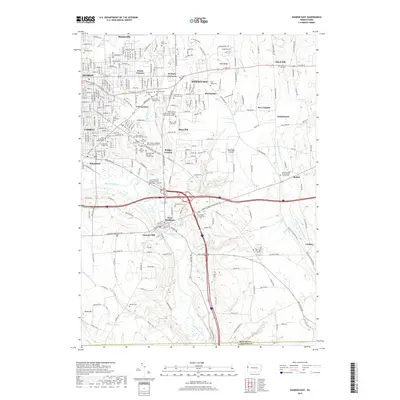
2019 Map of Sharon East
USGS Topo · Published 2019About this map
The Shenango River corridor defines the industrial and residential development of this western Pennsylvania region, where the urban centers of Sharon, Farrell, and Sharpsville anchor the landscape. The geography is heavily influenced by the drainage of several local runs, including Pine Hollow Run, Bobby Run, and Hogback Run, which carve through the terrain toward the river valley. The density of religious and cultural sites in the central townships is striking, particularly evidenced by the concentration of parish cemeteries such as Saint Michael Byzantine Catholic Cem and the Holy Trinity Hungarian Roman Catholic Cem.
Find a feature on this map
63 named features on this map. Tap any name to fly to it.
Don’t see what you’re looking for? This feature index may not catch every label — zoom into the map to look around manually.
Map Details
Editions of this 2019 Sharon East Map
This is the sole edition of this map. No revisions or reprints were ever made.
Other maps of this area

1905 · Neshannock
USGS Topo · 1:62,500

1906 · Youngstown
USGS Topo · 1:62,500

1907 · Neshannock
USGS Topo · 1:62,500

1907 · Kinsman
USGS Topo · 1:62,500

1908 · Shenango
USGS Topo · 1:62,500

1908 · Youngstown
USGS Topo · 1:62,500

1950 · Cleveland
USGS Topo · 1:250,000

1951 · Campbell
USGS Topo · 1:24,000

1954 · Sharon West
USGS Topo · 1:24,000

1956 · Cleveland
USGS Topo · 1:250,000