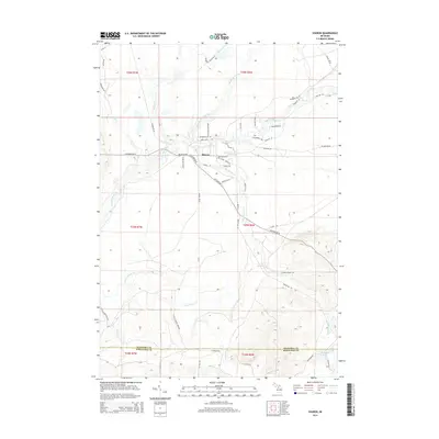
2014 Map of Sharon
USGS Topo · Published 2014About this map
The settlement of Sharon serves as a central point in this landscape of the upper Manistee River basin, where the N Br Manistee River and the main stem of the Manistee River converge. The terrain is defined by a dense network of tributaries including Big Devil Cr, Little Devil Cr, and Pierson Cr that cut through the glacial topography of northern Michigan. Further south, the map details the descent toward the Kalkaska and Missaukee County line, featuring the larger Little Cannon Creek and the secluded Horseshoe Lake. The road system, including the notably named Number 16 Railroad Se and Military Rd Se, reflects the region's history of resource extraction and movement, while local landmarks like Church Rd point toward the enduring rural community structure in this part of Garfield Township.
Find a feature on this map
56 named features on this map. Tap any name to fly to it.
Don’t see what you’re looking for? This feature index may not catch every label — zoom into the map to look around manually.
Map Details
Editions of this 2014 Sharon Map
This is the sole edition of this map. No revisions or reprints were ever made.
Other maps of this area

1949 · Black Creek
USGS Topo · 1:24,000

1949 · Fletcher
USGS Topo · 1:62,500

1950 · Fletcher
USGS Topo · 1:24,000

1954 · Traverse City
USGS Topo · 1:250,000

1956 · Kalkaska
USGS Topo · 1:62,500

1956 · Houghton Lake
USGS Topo · 1:62,500

1956 · Lake City
USGS Topo · 1:62,500

1958 · Traverse City
USGS Topo · 1:250,000

1983 · Cadillac
USGS Topo · 1:100,000

1983 · Stittsville
USGS Topo · 1:24,000