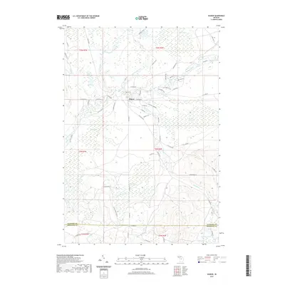
2019 Map of Sharon
USGS Topo · Published 2019About this map
Sharon serves as the central hub of this northern Michigan landscape, situated where the N Br Manistee River and Manistee River converge. The terrain is defined by a vast network of wetlands, including the sprawling Big Devil Swamp, O'Neil Swamp, and Little Cannon Creek Swamp, illustrating a landscape shaped by glacial deposits and slow-moving water. This area of Kalkaska County is crisscrossed by established local routes like S Military Rd and Co Hwy 571, which navigate between the numerous creek systems like Pierson Creek and Big Cannon Cr. To the south, the boundary between Kalkaska Co and Missaukee Co passes just north of Horseshoe Lake, marking the transition into more varied elevation patterns. The map detail highlights how rural development has clustered near the river bends and at the fringes of these significant swamp systems.
Find a feature on this map
66 named features on this map. Tap any name to fly to it.
Don’t see what you’re looking for? This feature index may not catch every label — zoom into the map to look around manually.
Map Details
Editions of this 2019 Sharon Map
This is the sole edition of this map. No revisions or reprints were ever made.
Other maps of this area

1949 · Black Creek
USGS Topo · 1:24,000

1949 · Fletcher
USGS Topo · 1:62,500

1950 · Fletcher
USGS Topo · 1:24,000

1954 · Traverse City
USGS Topo · 1:250,000

1956 · Kalkaska
USGS Topo · 1:62,500

1956 · Houghton Lake
USGS Topo · 1:62,500

1956 · Lake City
USGS Topo · 1:62,500

1958 · Traverse City
USGS Topo · 1:250,000

1983 · Cadillac
USGS Topo · 1:100,000

1983 · Stittsville
USGS Topo · 1:24,000