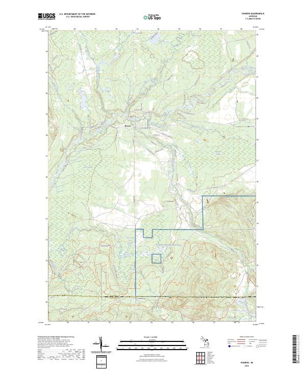
2023 Map of Sharon
USGS Topo · Published 2023About this map
Sharon serves as the central settlement in this portion of Kalkaska County, positioned near the confluence of the Manistee River and its major tributaries. The landscape is defined by an extensive network of wetlands and seasonal drainages, including O'Neil Swamp, Watson Swamp, and the massive Big Devil Swamp. These lowlands flank the North Branch Manistee River and smaller streams like Little Devil Creek, creating a complex aquatic environment that has long influenced local movement and land use. To the south, the terrain transitions across the boundary into Missaukee County, where Little Cannon Creek and Big Cannon Creek feed into the Little Cannon Creek Swamp. The presence of several named water bodies, such as Horseshoe Lake 2 and Round Swamp, highlights the glacial legacy of this northern Michigan region. A network of rural routes like S Military Rd and Co Hwy 571 provides access through these marshy reaches, connecting the scattered homesteads and timberlands that characterize the area.
Find a feature on this map
71 named features on this map. Tap any name to fly to it.
Don’t see what you’re looking for? This feature index may not catch every label — zoom into the map to look around manually.
Map Details
Editions of this 2023 Sharon Map
This is the sole edition of this map. No revisions or reprints were ever made.
Other maps of this area

1949 · Black Creek
USGS Topo · 1:24,000

1949 · Fletcher
USGS Topo · 1:62,500

1950 · Fletcher
USGS Topo · 1:24,000

1954 · Traverse City
USGS Topo · 1:250,000

1956 · Kalkaska
USGS Topo · 1:62,500

1956 · Houghton Lake
USGS Topo · 1:62,500

1956 · Lake City
USGS Topo · 1:62,500

1958 · Traverse City
USGS Topo · 1:250,000

1983 · Cadillac
USGS Topo · 1:100,000

1983 · Stittsville
USGS Topo · 1:24,000