
1943 Map of Sharon Springs
USGS Topo · Published 1955About this map
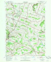
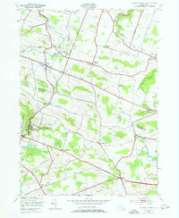
Sharon Springs serves as the focal point of this mid-century landscape, positioned along the edge of the Sharon plateau near the border of Montgomery and Schoharie Counties. The area is characterized by a dense network of local schools and family-named cemeteries, including Flanders Cem and Olmstead Cem, indicating a long-established rural community fabric. The terrain is defined by the headwaters of Canajoharie Creek and Flat Creek, which carve through the uplands near Mapletown (Blaine) and Ames.
Find a feature on this map
45 named features on this map. Tap any name to fly to it.
Don’t see what you’re looking for? This feature index may not catch every label — zoom into the map to look around manually.
Map Details
Editions of this 1943 Sharon Springs Map
3 editions found
Other maps of this area

1896 · Fonda
USGS Topo · 1:62,500

1898 · Fonda
USGS Topo · 1:62,500

1898 · Canajoharie
USGS Topo · 1:62,500

1898 · Schoharie
USGS Topo · 1:62,500

1900 · Canajoharie
USGS Topo · 1:62,500

1900 · Schoharie
USGS Topo · 1:62,500

1902 · Canajoharie
USGS Topo · 1:62,500

1902 · Fonda
USGS Topo · 1:62,500

1904 · Richmondville
USGS Topo · 1:62,500

1943 · Cobleskill
USGS Topo · 1:24,000