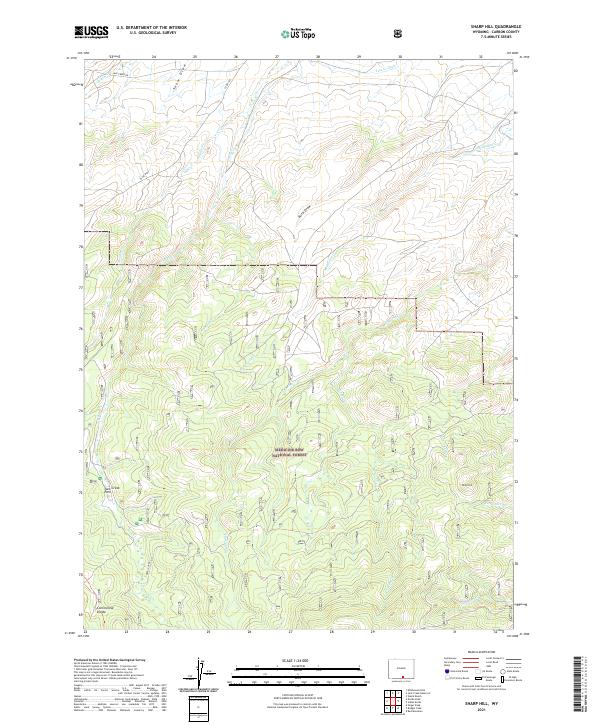
2021 Map of Sharp Hill
USGS Topo · Published 2021About this map
The Continental Divide traverses the southern portion of this high-elevation landscape in Carbon County, marking a fundamental hydrologic boundary amidst the timber and meadows of Medicine Bow National Forest. The drainage patterns here are intricate, defined by numerous named waterways including Jack Creek, Methodist Cr, and McLain Cr that flow through varied topography like Buck Draw and Snow Draw. This area is a hub for high-country activity, centered around Jack Creek Park.
Find a feature on this map
28 named features on this map. Tap any name to fly to it.
Don’t see what you’re looking for? This feature index may not catch every label — zoom into the map to look around manually.
Map Details
Editions of this 2021 Sharp Hill Map
This is the sole edition of this map. No revisions or reprints were ever made.
Other maps of this area

1932 · Savery
USGS Topo · 1:96,000

1939 · Saratoga
USGS Topo · 1:125,000

1940 · Savery
USGS Topo · 1:125,000

1954 · Rawlins
USGS Topo · 1:250,000

1958 · Rawlins
USGS Topo · 1:250,000

1961 · Red Mountain
USGS Topo · 1:24,000

1961 · Divide Peak
USGS Topo · 1:24,000

1961 · Middlewood Hill
USGS Topo · 1:24,000

1961 · Bridger Peak
USGS Topo · 1:24,000

1961 · Jack Creek Reservoir
USGS Topo · 1:24,000