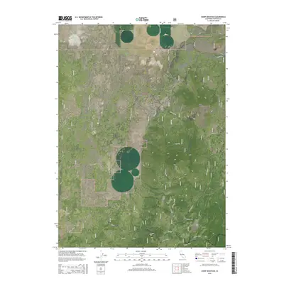
2015 Map of Sharp Mountain
USGS Topo · Published 2015About this map
Klamath National Forest defines this high-altitude landscape in Siskiyou County, where topographical peaks like Sharp Mountain and Wild Horse Mtn rise above the surrounding terrain. The map reflects a region shaped by natural water sources and early infrastructure, featuring numerous water points such as Antelope Well, Cedar Well, and Rainbow Well alongside the quiet waters of Russell Lake.
Find a feature on this map
31 named features on this map. Tap any name to fly to it.
Don’t see what you’re looking for? This feature index may not catch every label — zoom into the map to look around manually.
Map Details
Editions of this 2015 Sharp Mountain Map
This is the sole edition of this map. No revisions or reprints were ever made.
Other maps of this area

1886 · Modoc Lava Bed
USGS Topo · 1:250,000

1892 · Modoc Lava-Bed
USGS Topo · 1:250,000

1950 · Mt. Dome
USGS Topo · 1:62,500

1950 · Bray
USGS Topo · 1:62,500

1950 · Dorris
USGS Topo · 1:62,500

1952 · Medicine Lake
USGS Topo · 1:62,500

1954 · Alturas
USGS Topo · 1:250,000

1958 · Alturas
USGS Topo · 1:250,000

1962 · Alturas
USGS Topo · 1:250,000

1965 · Alturas
USGS Topo · 1:250,000