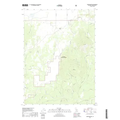
2018 Map of Sharp Mountain
USGS Topo · Published 2018About this map
Klamath National Forest dominates this section of Siskiyou County, where the high volcanic terrain transitions from the Red Rock Valley toward prominent peaks. The landscape is defined by massive topographic features like Sharp Mtn and Wild Horse Mtn, along with the multi-summited Three Sisters. Historical water access is visible through a network of isolated wells, including Antelope Well, Rainbow Well, and Lahondia Well, which supported ranching and transit across this high-elevation plateau.
Find a feature on this map
35 named features on this map. Tap any name to fly to it.
Don’t see what you’re looking for? This feature index may not catch every label — zoom into the map to look around manually.
Map Details
Editions of this 2018 Sharp Mountain Map
This is the sole edition of this map. No revisions or reprints were ever made.
Other maps of this area

1886 · Modoc Lava Bed
USGS Topo · 1:250,000

1892 · Modoc Lava-Bed
USGS Topo · 1:250,000

1950 · Mt. Dome
USGS Topo · 1:62,500

1950 · Bray
USGS Topo · 1:62,500

1950 · Dorris
USGS Topo · 1:62,500

1952 · Medicine Lake
USGS Topo · 1:62,500

1954 · Alturas
USGS Topo · 1:250,000

1958 · Alturas
USGS Topo · 1:250,000

1962 · Alturas
USGS Topo · 1:250,000

1965 · Alturas
USGS Topo · 1:250,000