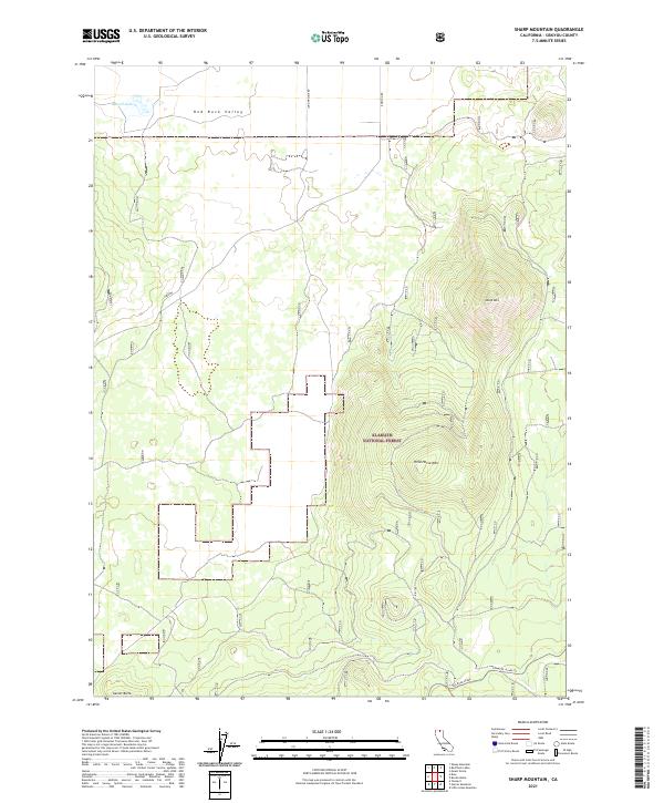
2021 Map of Sharp Mountain
USGS Topo · Published 2021About this map
Klamath National Forest anchors this high-elevation landscape in Siskiyou County, dominated by the prominent peaks of Sharp Mtn and Wild Horse Mtn. The topography transitions from the high ground of Garner Butte in the south to the open expanse of Red Rock Valley in the north, where the ephemeral Russell Lake sits. Evidence of historical transportation and industry is preserved in the southern portion of the quadrangle, where a significant Railroad Grade and the Lower Rr Grade Trl traverse the forest slopes. This network, alongside primitive routes like Long Prairie Rd and Robison Rd, provides a clear view of how high-country access was established and maintained for timber or transit through this portion of Northern California.
Find a feature on this map
15 named features on this map. Tap any name to fly to it.
Don’t see what you’re looking for? This feature index may not catch every label — zoom into the map to look around manually.
Map Details
Editions of this 2021 Sharp Mountain Map
This is the sole edition of this map. No revisions or reprints were ever made.
Other maps of this area

1886 · Modoc Lava Bed
USGS Topo · 1:250,000

1892 · Modoc Lava-Bed
USGS Topo · 1:250,000

1950 · Mt. Dome
USGS Topo · 1:62,500

1950 · Bray
USGS Topo · 1:62,500

1950 · Dorris
USGS Topo · 1:62,500

1952 · Medicine Lake
USGS Topo · 1:62,500

1954 · Alturas
USGS Topo · 1:250,000

1958 · Alturas
USGS Topo · 1:250,000

1962 · Alturas
USGS Topo · 1:250,000

1965 · Alturas
USGS Topo · 1:250,000