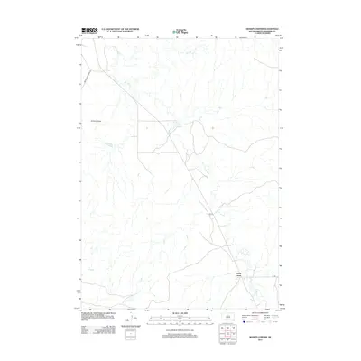
2012 Map of Sharps Corner
USGS Topo · Published 2012About this map
Sharps Corner serves as a primary local junction within the Oglala Lakota County landscape, situated where several key transportation routes converge. The terrain is defined by the winding course of Porcupine Cr, which meanders through the region, and the prominent elevation of Chimney Butte. This 2012 survey illustrates the modern infrastructure of the Pine Ridge Reservation area, detailing the network of tribal and federal roads including Indian Service Road 33, Bia 29, and Bia Rd. The map provides a clear look at the spatial relationship between these transport corridors and the natural drainage patterns of the creek, offering a precise record of the developed and natural features in this part of South Dakota.
Find a feature on this map
6 named features on this map. Tap any name to fly to it.
Don’t see what you’re looking for? This feature index may not catch every label — zoom into the map to look around manually.
Map Details
Editions of this 2012 Sharps Corner Map
This is the sole edition of this map. No revisions or reprints were ever made.
Other maps of this area

1950 · Stirk Table
USGS Topo · 1:24,000

1950 · Imlay SW
USGS Topo · 1:24,000

1950 · Imlay SE
USGS Topo · 1:24,000

1951 · Sharps Corner
USGS Topo · 1:24,000

1951 · Rockyford
USGS Topo · 1:24,000

1951 · Rockyford SE
USGS Topo · 1:24,000

1955 · Hot Springs
USGS Topo · 1:250,000

1981 · Wall
USGS Topo · 1:100,000

1981 · Evergreen
USGS Topo · 1:25,000

1981 · Evergreen NE
USGS Topo · 1:24,000