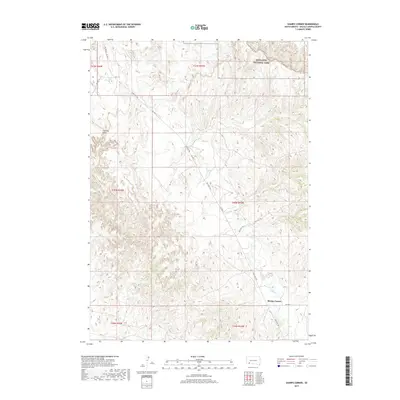
2017 Map of Sharps Corner
USGS Topo · Published 2017About this map
Sharps Corner sits at the intersection of local routes in this part of Oglala Lakota County, where the plains meet the striking geological formations of the northern border. The terrain is defined by the winding course of Porcupine Cr, which meanders through a landscape of sharp elevation changes and high points such as Chimney Butte. The northern edge of the map reveals the transition into the protected lands of Badlands National Park, characterized by the intricate contour lines of its famous eroded buttes and pinnacles. Transport in this region relies on a network of Bureau of Indian Affairs roads, including Bia Hwy 27 and Bia Hwy 2, along with trails that navigate the broken ground. The layout of these routes, such as N Big Foot Trl, reflects the historical and modern movement across the Pine Ridge Reservation landscape.
Find a feature on this map
16 named features on this map. Tap any name to fly to it.
Don’t see what you’re looking for? This feature index may not catch every label — zoom into the map to look around manually.
Map Details
Editions of this 2017 Sharps Corner Map
This is the sole edition of this map. No revisions or reprints were ever made.
Other maps of this area

1950 · Stirk Table
USGS Topo · 1:24,000

1950 · Imlay SW
USGS Topo · 1:24,000

1950 · Imlay SE
USGS Topo · 1:24,000

1951 · Sharps Corner
USGS Topo · 1:24,000

1951 · Rockyford
USGS Topo · 1:24,000

1951 · Rockyford SE
USGS Topo · 1:24,000

1955 · Hot Springs
USGS Topo · 1:250,000

1981 · Wall
USGS Topo · 1:100,000

1981 · Evergreen
USGS Topo · 1:25,000

1981 · Evergreen NE
USGS Topo · 1:24,000