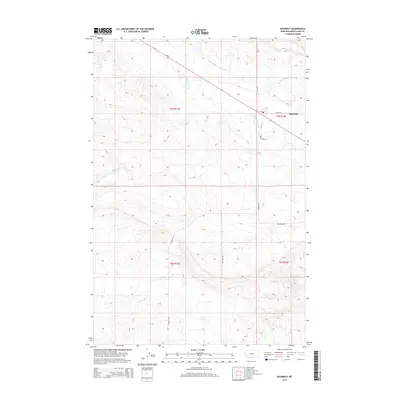
2014 Map of Shawmut
USGS Topo · Published 2014About this map
The Musselshell River meanders across this central Montana landscape, defining the character of a region where water management and ranching intersect. In the northeast corner, the small settlement of Shawmut serves as a local hub, anchored by its Po and the junction of Us-12 and S Shawmut Rd. The map illustrates a high-plains environment deeply influenced by irrigation infrastructure, most notably the Deadmans Basin Supply Canal which cuts across the northern terrain.
Find a feature on this map
14 named features on this map. Tap any name to fly to it.
Don’t see what you’re looking for? This feature index may not catch every label — zoom into the map to look around manually.
Map Details
Editions of this 2014 Shawmut Map
This is the sole edition of this map. No revisions or reprints were ever made.
Other maps of this area

1889 · Big Snowy Mountain
USGS Topo · 1:250,000

1893 · Big Snowy Mountain
USGS Topo · 1:250,000

1954 · Roundup
USGS Topo · 1:250,000

1958 · Roundup
USGS Topo · 1:250,000

1985 · Jim Creek
USGS Topo · 1:24,000

1985 · Progress
USGS Topo · 1:24,000
1985 · O'Brien Hill
USGS Topo · 1:24,000

1986 · Shawmut
USGS Topo · 1:24,000

1986 · Halbert Creek South
USGS Topo · 1:24,000
1986 · Deadmans Basin Reservoir
USGS Topo · 1:24,000