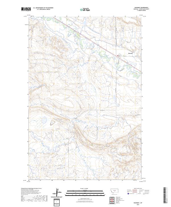
2024 Map of Shawmut
USGS Topo · Published 2024About this map
The settlement of Shawmut sits at a critical junction of water and transit in central Montana, where the Musselshell River winds through the valley floor. This 2024 survey documents the hydraulic infrastructure of Wheatland County, most notably the Deadmans Basin Supply Canal, which dictates the agricultural rhythm of the surrounding rangeland. The landscape is defined by the Public Land Survey System, with township boundaries like t7n r18e and t6n r17e framing the open country. Local ranching access is preserved through a network of rural routes, including Taber Ranch Ln and Mud Creek Rd, illustrating how modern parcels still align with historic riverbank and canal corridors. This map provides a clear record of the intersection between natural waterways and the engineered systems that support the region's ranching economy.
Find a feature on this map
13 named features on this map. Tap any name to fly to it.
Don’t see what you’re looking for? This feature index may not catch every label — zoom into the map to look around manually.
Map Details
Editions of this 2024 Shawmut Map
This is the sole edition of this map. No revisions or reprints were ever made.
Other maps of this area

1889 · Big Snowy Mountain
USGS Topo · 1:250,000

1893 · Big Snowy Mountain
USGS Topo · 1:250,000

1954 · Roundup
USGS Topo · 1:250,000

1958 · Roundup
USGS Topo · 1:250,000

1985 · Jim Creek
USGS Topo · 1:24,000

1985 · Progress
USGS Topo · 1:24,000
1985 · O'Brien Hill
USGS Topo · 1:24,000

1986 · Shawmut
USGS Topo · 1:24,000

1986 · Halbert Creek South
USGS Topo · 1:24,000
1986 · Deadmans Basin Reservoir
USGS Topo · 1:24,000