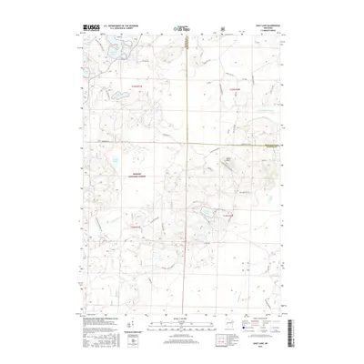
2015 Map of Shay Lake
USGS Topo · Published 2015About this map
The Nicolet National Forest encompasses this section of Northern Wisconsin, where the boundary between Oconto and Marinette counties follows section lines through a dense network of glacial lakes and wetlands. The terrain is defined by the prominent Butler Rock, which stands above a landscape of interconnected water bodies like Shay Lake, Turtle Lake, and Waupee Lake. This 2015 survey details a maze of forest access roads and tracks, including the Butler Rock Lookout Ln and Baenen Network, which navigate the rises between low-lying cedar swamps and open water. The drainage patterns of the W Br Peshtigo Brook and Little Waupee Cr illustrate the complex hydrology of the region, while labels like Old 64 Rd and Old Pansy Rd hint at the historic transport routes that preceded the modern forest road system.
Find a feature on this map
52 named features on this map. Tap any name to fly to it.
Don’t see what you’re looking for? This feature index may not catch every label — zoom into the map to look around manually.
Map Details
Editions of this 2015 Shay Lake Map
This is the sole edition of this map. No revisions or reprints were ever made.
Other maps of this area

1940 · Thunder Mtn.
USGS Topo · 1:48,000

1940 · Athelstane
USGS Topo · 1:48,000

1941 · Coleman
USGS Topo · 1:48,000

1942 · Athelstane
USGS Topo · 1:48,000

1942 · Coleman
USGS Topo · 1:48,000

1942 · Breed
USGS Topo · 1:48,000

1950 · Coleman
USGS Topo · 1:48,000

1951 · Thunder Mountain
USGS Topo · 1:48,000

1952 · Mountain
USGS Topo · 1:48,000

1954 · Iron Mountain
USGS Topo · 1:250,000