
1952 Map of Mountain
USGS Topo · Published 1955About this map
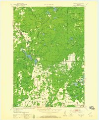
The North Western railroad line carves through a landscape of dense woodlands and numerous glacial lakes in this mid-century survey of Oconto County. Small agricultural and logging settlements like Mountain and Suring serve as anchors for the rural population, while the Nicolet National Forest dominates the northern terrain. The map records a transition from the wilder, lake-dotted highlands of Riverview to the emerging farmsteads of Maple Valley in the south.
Find a feature on this map
72 named features on this map. Tap any name to fly to it.
Don’t see what you’re looking for? This feature index may not catch every label — zoom into the map to look around manually.
Map Details
Editions of this 1952 Mountain Map
2 editions found
Other maps of this area

1940 · Thunder Mtn.
USGS Topo · 1:48,000

1940 · Athelstane
USGS Topo · 1:48,000

1941 · Coleman
USGS Topo · 1:48,000

1942 · Athelstane
USGS Topo · 1:48,000

1942 · Coleman
USGS Topo · 1:48,000

1942 · Breed
USGS Topo · 1:48,000

1942 · Wabeno
USGS Topo · 1:48,000

1950 · Wabeno
USGS Topo · 1:48,000

1950 · Coleman
USGS Topo · 1:48,000

1951 · Wabeno
USGS Topo · 1:48,000