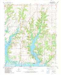
1982 Map of Shay
USGS Topo · Published 1983About this map
Lake Texoma dominates the southern landscape of Marshall County, with its indented shoreline at a Normal Pool Elevation 617. The map illustrates a rural Oklahoma community defined by its proximity to the water, featuring several public access points such as the Buncombe Creek Public Use Area and Brier Creek Public Use Area. The Oklahoma University Biological Station sits on the lakeshore, highlighting the area's significance for environmental research and education.
Find a feature on this map
36 named features on this map. Tap any name to fly to it.
Don’t see what you’re looking for? This feature index may not catch every label — zoom into the map to look around manually.
Map Details
Editions of this 1982 Shay Map
This is the sole edition of this map. No revisions or reprints were ever made.
Other maps of this area

1901 · Tishomingo
USGS Topo · 1:125,000

1901 · Denison
USGS Topo · 1:125,000

1954 · Sherman
USGS Topo · 1:250,000

1957 · Ardmore
USGS Topo · 1:250,000

1958 · Gordonville
USGS Topo · 1:62,500

1958 · Denison Dam
USGS Topo · 1:62,500

1958 · Sherman
USGS Topo · 1:250,000

1963 · Ardmore
USGS Topo · 1:250,000

1963 · Madill
USGS Topo · 1:24,000

1963 · Mc Millan
USGS Topo · 1:24,000