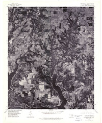
1976 Map of Gordonville NE
USGS Topo · Published 1979About this map
Lake Texoma dominates the southern landscape of this orthophotoquad, where the intricate shoreline of the reservoir meets the rural plateaus of Marshall County. This 1976 aerial perspective reveals the sharp contrast between the deeply wooded drainage ravines and the rectangular patchwork of cleared agricultural fields. The settlement pattern is defined by small, dispersed rural communities including Powell to the west and Shay and Enos to the east. The imagery captures the area just as it appeared in the mid-1970s, showing the early infrastructure of lake-access roads and the clustered homesteads at Fobb and Willis. This photographic record provides a clear view of the land use transitions and the natural erosion patterns shaping the Red River basin before further modern development altered these rural Oklahoma townships.
Find a feature on this map
6 named features on this map. Tap any name to fly to it.
Don’t see what you’re looking for? This feature index may not catch every label — zoom into the map to look around manually.
Map Details
Editions of this 1976 Gordonville NE Map
2 editions found
Other maps of this area

1901 · Tishomingo
USGS Topo · 1:125,000

1901 · Denison
USGS Topo · 1:125,000

1954 · Sherman
USGS Topo · 1:250,000

1957 · Ardmore
USGS Topo · 1:250,000

1958 · Gordonville
USGS Topo · 1:62,500

1958 · Denison Dam
USGS Topo · 1:62,500

1958 · Sherman
USGS Topo · 1:250,000

1963 · Ardmore
USGS Topo · 1:250,000

1963 · Madill
USGS Topo · 1:24,000

1963 · Mc Millan
USGS Topo · 1:24,000