
1901 Map of Tishomingo
USGS Topo · Published 1901About this map
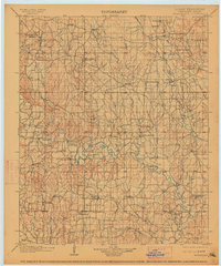
The Chickasaw Nation in Indian Territory is defined here by the winding course of the Washita River and the growing regional center of Tishomingo. Surveyed in the late 1890s, the landscape reveals a transition from frontier military presence to early industrial extraction, most notably at the Asphalt Mines near Gilsonite and several early Oil Well sites. The map documents numerous rural settlements like Mill Creek, Pontotoc, and Emet, alongside educational and religious institutions such as the Harley Institute and Pilgrim Chapel. A significant historical landmark is the site of Fort Washita (Abandoned) near the confluence of the river and Rock Creek, anchoring the southeastern portion of the quadrangle. This survey captures the intricate network of creeks—including Pennington Creek and Blue Creek—that dictated the placement of schools like Seely School House and ferry crossings before the region's full integration into Oklahoma statehood.
Find a feature on this map
78 named features on this map. Tap any name to fly to it.
Don’t see what you’re looking for? This feature index may not catch every label — zoom into the map to look around manually.
Map Details
Editions of this 1901 Tishomingo Map
4 editions found
Other maps of this area

1896 · Coalgate
USGS Topo · 1:125,000

1898 · Pauls Valley
USGS Topo · 1:125,000

1899 · Coalgate
USGS Topo · 1:125,000

1899 · Atoka
USGS Topo · 1:125,000

1900 · Atoka
USGS Topo · 1:125,000

1900 · Coalgate
USGS Topo · 1:125,000

1901 · Stonewall
USGS Topo · 1:125,000

1901 · Ardmore
USGS Topo · 1:125,000

1901 · Denison
USGS Topo · 1:125,000

1902 · Gainesville
USGS Topo · 1:125,000