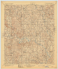
1901 Map of Tishomingo
USGS Topo · Published 1932About this map
Tishomingo and the surrounding Chickasaw Nation lands are documented here at the close of the nineteenth century, as the region’s topography was first systematically recorded by topographers C.H. Fitch and Van. H. Manning. The landscape is defined by the winding course of the Washita River and the Blue River, punctuated by early industrial efforts such as the Asphalt Mines and Gilsonite works in the northwest. Local education and religious life are visible through landmarks like the Harley Institute, Seely School House, and Pilgrim Chapel. Transportation in this era relied on the St. Louis and San Francisco R. R. and river crossings like the Ferry near Norton. The presence of Fort Washita (Abandoned) and an abandoned oil well reflects the shifting footprints of military and commercial ventures in the Indian Territory frontier.
Find a feature on this map
83 named features on this map. Tap any name to fly to it.
Don’t see what you’re looking for? This feature index may not catch every label — zoom into the map to look around manually.
Map Details
Editions of this 1901 Tishomingo Map
4 editions found
Other maps of this area

1896 · Coalgate
USGS Topo · 1:125,000

1898 · Pauls Valley
USGS Topo · 1:125,000

1899 · Coalgate
USGS Topo · 1:125,000

1899 · Atoka
USGS Topo · 1:125,000

1900 · Atoka
USGS Topo · 1:125,000

1900 · Coalgate
USGS Topo · 1:125,000

1901 · Stonewall
USGS Topo · 1:125,000

1901 · Tishomingo
USGS Topo · 1:125,000

1901 · Ardmore
USGS Topo · 1:125,000

1901 · Denison
USGS Topo · 1:125,000