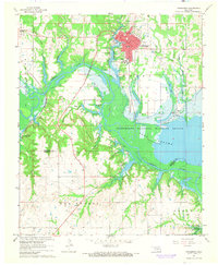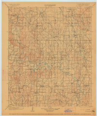
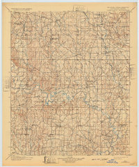
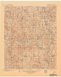
1901 Map of Tishomingo
USGS Topo · Published 1914About this map
The Washita River meanders across this late 19th-century survey of the Chickasaw Nation, revealing a landscape transitioning between tribal territory and the industrializing frontier. Central to the map is the original settlement of Tishomingo and the nearby New Tishomingo, reflecting the administrative heart of the nation during a period of rapid development. Educational and social foundations are represented by the Harley Institute and the Seely School House, while the presence of the Asphalt Mines Gilsonite in the northwest and an Oil Well near the river signals the early extraction economy.
Find a feature on this map
80 named features on this map. Tap any name to fly to it.
Don’t see what you’re looking for? This feature index may not catch every label — zoom into the map to look around manually.
Map Details
Editions of this 1901 Tishomingo Map
4 editions found

Historical Maps of Ardmore Through Time
8 maps found