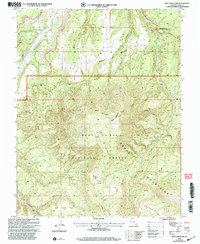
2001 Map of Shay Mountain
USGS Topo · Published 2004About this map
Newspaper Rock National Historic Site stands as a focal point in the northeast corner of this high-elevation terrain, where Indian Creek flows through deep canyons. The landscape is dominated by the massive rise of the Abajo Mountains, reaching its peak at Shay Mountain. This 2001 revision illustrates the land management patterns of the Manti-La Sal National Forest, including numerous protraction blocks and high-altitude features like Spring Lake and the Robertson Pasture area. Evidence of early land use and antiquity is grounded in labels for Ruins and a Corral near the headwaters of North Cottonwood Creek. The map details a complex drainage system where Titus Canyon and Shay Canyon carve through Shay Mesa, revealing the intricate topography that has long dictated movement and settlement in this corner of San Juan County.
Find a feature on this map
31 named features on this map. Tap any name to fly to it.
Don’t see what you’re looking for? This feature index may not catch every label — zoom into the map to look around manually.
Map Details
Editions of this 2001 Shay Mountain Map
This is the sole edition of this map. No revisions or reprints were ever made.
Other maps of this area

1885 · La Sal
USGS Topo · 1:250,000

1886 · Abajo
USGS Topo · 1:250,000

1892 · Abajo
USGS Topo · 1:250,000

1893 · Abajo
USGS Topo · 1:250,000

1935 · Elk Ridge
USGS Topo · 1:96,000

1940 · Elk Ridge
USGS Topo · 1:125,000

1954 · Elk Ridge 1 SW
USGS Topo · 1:24,000

1954 · Elk Ridge 1 NW
USGS Topo · 1:24,000

1954 · Elk Ridge 1 NE
USGS Topo · 1:24,000

1954 · Carlisle 4 SW
USGS Topo · 1:24,000