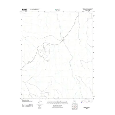
2012 Map of Shedd Canyon
USGS Topo · Published 2012About this map
Indian Cr and its ephemeral tributaries like Dry Cr carve through the arid terrain of eastern San Luis Obispo County, defining the rural landscape of this central California quadrangle. Large agricultural holdings and camps are the primary markers of human presence, including CW Clarke Ranch and Upton Ranch. The drainage patterns of Shedd Canyon and Upton Canyon guide the local road network, where thoroughfares such as La Panza Rd and Ryan Rd connect scattered outposts like Walters Camp and Eddy Camp. The map illustrates a region characterized by wide-open spaces and ranching life, where water sources like Quail Water Cr remain critical landmarks for navigation and land management. This 2012 edition documents the enduring cattle ranching tradition and the specific property boundaries of family-named sites such as Jackson and Reinhert Ranch.
Find a feature on this map
32 named features on this map. Tap any name to fly to it.
Don’t see what you’re looking for? This feature index may not catch every label — zoom into the map to look around manually.
Map Details
Editions of this 2012 Shedd Canyon Map
This is the sole edition of this map. No revisions or reprints were ever made.
Other maps of this area

1897 · San Luis Obispo
USGS Topo · 1:62,500

1900 · San Luis
USGS Topo · 1:125,000

1914 · Cholame
USGS Topo · 1:125,000

1915 · Cholame
USGS Topo · 1:125,000

1917 · Cholame
USGS Topo · 1:125,000

1919 · Paso Robles
USGS Topo · 1:62,500

1922 · Pozo
USGS Topo · 1:62,500

1942 · San Luis Obispo
USGS Topo · 1:62,500

1943 · Shandon
USGS Topo · 1:31,680

1943 · Paso Robles
USGS Topo · 1:62,500