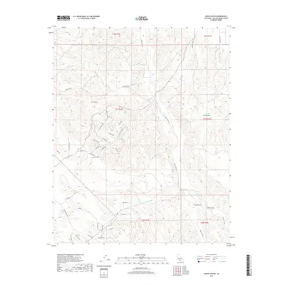
2018 Map of Shedd Canyon
USGS Topo · Published 2018About this map
The Governor Edmund G Brown Coastal Br California Aqueduct cuts a modern engineered line across the southern portion of this landscape, contrasting with the ancient drainage patterns of the Central Coast Ranges. The area is defined by a series of significant canyons including Dry Canyon, Wood Canyon, Shedd Canyon, and Upton Canyon, which funnel seasonal runoff toward Indian Cr and Quail Water Cr. While the terrain remains largely rural, a network of residential roads like Amber Hills Way, Sunburst Rd, and Squirrel Pl shows the localized expansion of contemporary homesteads and rural development into the hills. Traditional transit routes such as Creston Valley Rd and Carrizo Plains Rd connect this rugged interior to the broader San Luis Obispo County region, tracing the natural contours of the land established by generations of travel.
Find a feature on this map
44 named features on this map. Tap any name to fly to it.
Don’t see what you’re looking for? This feature index may not catch every label — zoom into the map to look around manually.
Map Details
Editions of this 2018 Shedd Canyon Map
This is the sole edition of this map. No revisions or reprints were ever made.
Other maps of this area

1897 · San Luis Obispo
USGS Topo · 1:62,500

1900 · San Luis
USGS Topo · 1:125,000

1914 · Cholame
USGS Topo · 1:125,000

1915 · Cholame
USGS Topo · 1:125,000

1917 · Cholame
USGS Topo · 1:125,000

1919 · Paso Robles
USGS Topo · 1:62,500

1922 · Pozo
USGS Topo · 1:62,500

1942 · San Luis Obispo
USGS Topo · 1:62,500

1943 · Shandon
USGS Topo · 1:31,680

1943 · Paso Robles
USGS Topo · 1:62,500