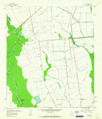
1961 Map of Sheeks
USGS Topo · Published 1964About this map
Industrial and agricultural development define this landscape on the border of Liberty, Chambers, and Harris counties in the early 1960s. The Esperson Dome Oil Field and the adjacent Gum Bayou Oil Field dominate the central terrain, characterized by a dense network of pipelines and numerous pumping stations. This extraction activity sits alongside an extensive water management system, including the Dayton Canal and Barbers Hill Canal, designed to move water across the low-lying coastal plains.
Find a feature on this map
37 named features on this map. Tap any name to fly to it.
Don’t see what you’re looking for? This feature index may not catch every label — zoom into the map to look around manually.
Map Details
Editions of this 1961 Sheeks Map
This is the sole edition of this map. No revisions or reprints were ever made.
Other maps of this area

1916 · Burnett Bay
USGS Topo · 1:24,000

1916 · Crosby
USGS Topo · 1:24,000

1916 · Cedar Bayou
USGS Topo · 1:24,000

1916 · Huffman
USGS Topo · 1:24,000

1919 · Crosby
USGS Topo · 1:31,680

1919 · Cedar Bayou
USGS Topo · 1:31,680

1920 · Highlands
USGS Topo · 1:31,680

1920 · Huffman
USGS Topo · 1:31,680

1943 · Liberty
USGS Topo · 1:125,000

1943 · Cedar Bayou
USGS Topo · 1:24,000