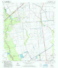
1993 Map of Sheeks
USGS Topo · Published 1994About this map
The Esperson Dome Oil Field dominates this landscape, characterized by a dense network of oil wells, pipelines, and access roads in Liberty and Harris counties. This industrial activity is woven through a low-lying terrain of bayous and drainage systems, where water management is visible through the Coastal Water Authority Canal and the Dayton Canal. Small settlements like Sheeks and Gum Island provide anchor points for local history, while the Harvey Cem offers a genealogical link to the area's early residents.
Find a feature on this map
38 named features on this map. Tap any name to fly to it.
Don’t see what you’re looking for? This feature index may not catch every label — zoom into the map to look around manually.
Map Details
Editions of this 1993 Sheeks Map
This is the sole edition of this map. No revisions or reprints were ever made.
Other maps of this area

1916 · Burnett Bay
USGS Topo · 1:24,000

1916 · Crosby
USGS Topo · 1:24,000

1916 · Cedar Bayou
USGS Topo · 1:24,000

1916 · Huffman
USGS Topo · 1:24,000

1919 · Crosby
USGS Topo · 1:31,680

1919 · Cedar Bayou
USGS Topo · 1:31,680

1920 · Highlands
USGS Topo · 1:31,680

1920 · Huffman
USGS Topo · 1:31,680

1943 · Liberty
USGS Topo · 1:125,000

1943 · Cedar Bayou
USGS Topo · 1:24,000