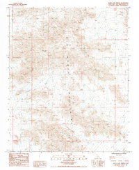
1985 Map of Sheep Camp Spring
USGS Topo · Published 1985About this map
The Old Woman Mountains dominate this 1980s landscape in San Bernardino County, where the topography transitions into the broad expanse of Ward Valley. This arid environment is defined by its drainage patterns and isolated water sources, most notably at Sheep Camp Spring. The presence of the Black Metal Mine and several other identified sites labeled as Prospect or Prospects points to a history of mineral exploration in the mid-20th century. Arroyos like Browns Wash indicate the seasonal flow of water through the desert floor, while the survey grid lines for townships and ranges, such as R 16 E and T 5 N, provide the formal structure for this remote California interior.
Find a feature on this map
11 named features on this map. Tap any name to fly to it.
Don’t see what you’re looking for? This feature index may not catch every label — zoom into the map to look around manually.
Map Details
Editions of this 1985 Sheep Camp Spring Map
This is the sole edition of this map. No revisions or reprints were ever made.
Other maps of this area

1942 · Amboy
USGS Topo · 1:250,000

1943 · Amboy
USGS Topo · 1:250,000

1943 · Essex
USGS Topo · 1:62,500

1943 · Danby
USGS Topo · 1:62,500

1943 · Cadiz Lake
USGS Topo · 1:62,500

1954 · Needles
USGS Topo · 1:250,000

1956 · Needles
USGS Topo · 1:250,000

1956 · Milligan
USGS Topo · 1:62,500

1956 · Essex
USGS Topo · 1:62,500

1956 · Cadiz Lake
USGS Topo · 1:62,500