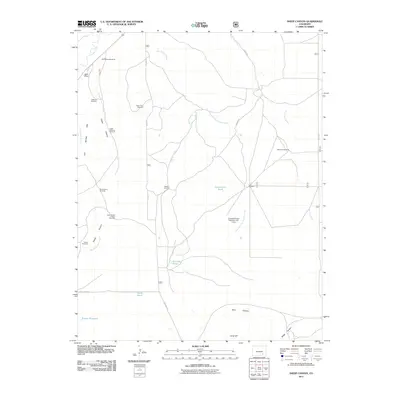
2011 Map of Sheep Canyon
USGS Topo · Published 2011About this map
Sheep Canyon and its associated arroyos define this Otero County landscape, where water management is the primary marker of human activity. The map reveals an extensive network of windmills used for cattle ranching, including the Bull Pasture Windmill, Hoffman Windmill, and Black Tank Windmill. These points of reliance are connected by a sparse network of rural routes such as Co RD 13 and Aguire RD.
Find a feature on this map
32 named features on this map. Tap any name to fly to it.
Don’t see what you’re looking for? This feature index may not catch every label — zoom into the map to look around manually.
Map Details
Editions of this 2011 Sheep Canyon Map
This is the sole edition of this map. No revisions or reprints were ever made.
Other maps of this area

1891 · Timpas
USGS Topo · 1:125,000

1894 · Timpas
USGS Topo · 1:125,000

1955 · La Junta
USGS Topo · 1:250,000

1958 · La Junta
USGS Topo · 1:250,000

1965 · La Junta SW
USGS Topo · 1:24,000

1968 · La Junta
USGS Topo · 1:250,000

1972 · Packers Gap
USGS Topo · 1:24,000
1972 · Stage Canyon
USGS Topo · 1:24,000
1972 · Timpas SW
USGS Topo · 1:24,000
1972 · Lockwood Arroyo
USGS Topo · 1:24,000