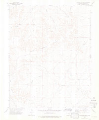
1972 Map of Lockwood Arroyo
USGS Topo · Published 1976About this map
Bear Springs Hills and the Big Arroyo Hills dominate this high plains landscape in southern Colorado, where water is the primary architect of the terrain. The drainage system is remarkably intricate, defined by the winding course of the Lockwood Arroyo and a network of seasonal watercourses including Bear Springs Arroyo, Middle Bear Springs Arroyo, and West Bear Springs Arroyo. This 1970s survey captures a sparse, ranching-oriented environment where human intervention is limited to occasional windmills and a prominent Pipeline cutting across the topography. The presence of numerous springs and the complex arroyo systems suggest a landscape where grazing and water rights were central to local land use. Fine red dashed lines throughout the quadrangle mark fence lines, indicating the division of this open range into distinct parcels.
Find a feature on this map
9 named features on this map. Tap any name to fly to it.
Don’t see what you’re looking for? This feature index may not catch every label — zoom into the map to look around manually.
Map Details
Editions of this 1972 Lockwood Arroyo Map
4 editions found
Other maps of this area

1891 · Timpas
USGS Topo · 1:125,000

1891 · Apishapa
USGS Topo · 1:125,000

1891 · Mesa De Maya
USGS Topo · 1:125,000

1892 · Elmoro
USGS Topo · 1:125,000

1893 · Apishapa
USGS Topo · 1:125,000

1893 · Elmoro
USGS Topo · 1:125,000

1893 · Mesa de Maya
USGS Topo · 1:125,000

1894 · Timpas
USGS Topo · 1:125,000

1897 · Elmoro
USGS Topo · 1:125,000

1897 · Apishapa
USGS Topo · 1:125,000