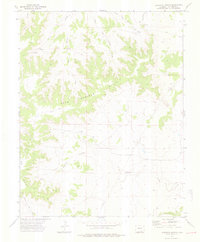
1972 Map of Lockwood Arroyo
USGS Topo · Published 1976About this map
Bear Springs Hills and the Big Arroyo Hills define the high ground of this Las Animas County landscape, where an intricate network of seasonal drainages has carved the terrain. The map captures a moment in the early 1970s when the region was primarily utilized for ranching and utility transport. The convergence of East Bear Springs Arroyo, Middle Bear Springs Arroyo, and West Bear Springs Arroyo creates a complex system of canyons that eventually feed into the larger Lockwood Arroyo.
Find a feature on this map
11 named features on this map. Tap any name to fly to it.
Don’t see what you’re looking for? This feature index may not catch every label — zoom into the map to look around manually.
Map Details
Editions of this 1972 Lockwood Arroyo Map
4 editions found
Other maps of this area

1891 · Timpas
USGS Topo · 1:125,000

1891 · Apishapa
USGS Topo · 1:125,000

1891 · Mesa De Maya
USGS Topo · 1:125,000

1892 · Elmoro
USGS Topo · 1:125,000

1893 · Apishapa
USGS Topo · 1:125,000

1893 · Elmoro
USGS Topo · 1:125,000

1893 · Mesa de Maya
USGS Topo · 1:125,000

1894 · Timpas
USGS Topo · 1:125,000

1897 · Elmoro
USGS Topo · 1:125,000

1897 · Apishapa
USGS Topo · 1:125,000