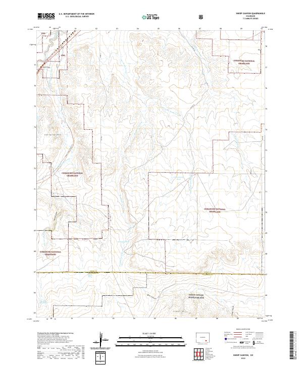
2022 Map of Sheep Canyon
USGS Topo · Published 2022About this map
The Comanche National Grassland dominates this portion of the Colorado plains, where the modern landscape preserves the deep-time heritage of the westward migration. The Santa Fe National Historic Trl cuts across the northwestern corner, a silent reminder of the historic trade route that once linked the Missouri River to New Mexico. This rugged terrain is defined by a network of seasonal watercourses and ridges, including the Iron Springs Hills and Jack Point.
Find a feature on this map
28 named features on this map. Tap any name to fly to it.
Don’t see what you’re looking for? This feature index may not catch every label — zoom into the map to look around manually.
Map Details
Editions of this 2022 Sheep Canyon Map
This is the sole edition of this map. No revisions or reprints were ever made.
Other maps of this area

1891 · Timpas
USGS Topo · 1:125,000

1894 · Timpas
USGS Topo · 1:125,000

1955 · La Junta
USGS Topo · 1:250,000

1958 · La Junta
USGS Topo · 1:250,000

1965 · La Junta SW
USGS Topo · 1:24,000

1968 · La Junta
USGS Topo · 1:250,000

1972 · Packers Gap
USGS Topo · 1:24,000
1972 · Stage Canyon
USGS Topo · 1:24,000
1972 · Timpas SW
USGS Topo · 1:24,000
1972 · Lockwood Arroyo
USGS Topo · 1:24,000