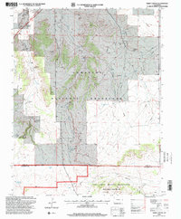
1996 Map of Sheep Canyon
USGS Topo · Published 2000About this map
Comanche National Grassland dominates this high-plains landscape, where the legacy of the Old West meets modern military utility. The map traces the path of the Santa Fe National Historic Trail as it cuts across the northwestern corner near Timpas Creek, marking a corridor used by generations of traders and pioneers. The southern portion of the sheet transitions into the Fort Carson Military Reservation, specifically identifying the Piñon Canyon Maneuver Site, highlighting the area's strategic 20th-century importance.
Find a feature on this map
29 named features on this map. Tap any name to fly to it.
Don’t see what you’re looking for? This feature index may not catch every label — zoom into the map to look around manually.
Map Details
Editions of this 1996 Sheep Canyon Map
This is the sole edition of this map. No revisions or reprints were ever made.
Other maps of this area

1891 · Timpas
USGS Topo · 1:125,000

1894 · Timpas
USGS Topo · 1:125,000

1955 · La Junta
USGS Topo · 1:250,000

1958 · La Junta
USGS Topo · 1:250,000

1965 · La Junta SW
USGS Topo · 1:24,000

1968 · La Junta
USGS Topo · 1:250,000

1972 · Packers Gap
USGS Topo · 1:24,000
1972 · Stage Canyon
USGS Topo · 1:24,000
1972 · Timpas SW
USGS Topo · 1:24,000
1972 · Lockwood Arroyo
USGS Topo · 1:24,000