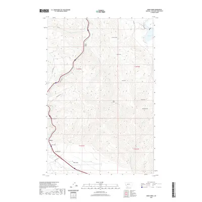
2020 Map of Sheep Creek
USGS Topo · Published 2020About this map
Little Prickly Pear Cr and Sheep Cr converge in this high-altitude landscape of Lewis and Clark County, where narrow valleys and gulches define the terrain. The settlement at Sieben sits at the southwestern edge of the quadrangle near Bear Gulch, serving as a key point of interest for researchers tracing the early 20th-century ranching and transit corridors of this region. The northern section of the map reveals the waters of the Missouri River and Holter Lake, illustrating the topographical transition from mountain drainages to significant river systems. Notable landforms such as Hilger Valley and various named drainages like Rose Gulch and Falls Gulch provide a clear view of the complex hydrology that feeds into the Missouri basin. Transport infrastructure is anchored by the Sheep Creek Bridge and historical routes like Woods Siding Rd and Recreation Rd S.
Find a feature on this map
31 named features on this map. Tap any name to fly to it.
Don’t see what you’re looking for? This feature index may not catch every label — zoom into the map to look around manually.
Map Details
Editions of this 2020 Sheep Creek Map
This is the sole edition of this map. No revisions or reprints were ever made.
Other maps of this area

1886 · Great Falls
USGS Topo · 1:250,000

1886 · Fort Logan
USGS Topo · 1:250,000

1889 · Helena
USGS Topo · 1:250,000

1893 · Helena
USGS Topo · 1:250,000

1899 · Helena
USGS Topo · 1:250,000

1903 · Helena
USGS Topo · 1:250,000

1943 · Hogan
USGS Topo · 1:125,000

1947 · Butte
USGS Topo · 1:250,000

1948 · White Sulphur Springs
USGS Topo · 1:250,000

1954 · Great Falls
USGS Topo · 1:250,000