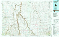
1989 Map of Sheep Creek
USGS Topo · Published 1989About this map
Bruneau Canyon dominates this arid landscape, carving a deep path through the extensive plateaus of the Blackstone Desert and Diamond A Desert. The drainage network is defined by the Bruneau River and the East Fork Bruneau River, which converge amidst a series of high mesas including Arch Table and Columbet Table. Settlement is sparse, centered primarily around the community of Grasmere and its nearby landing strip.
Find a feature on this map
84 named features on this map. Tap any name to fly to it.
Don’t see what you’re looking for? This feature index may not catch every label — zoom into the map to look around manually.
Map Details
Editions of this 1989 Sheep Creek Map
This is the sole edition of this map. No revisions or reprints were ever made.
Other maps of this area

1936 · Mountain City
USGS Topo · 1:62,500

1936 · Rowland
USGS Topo · 1:48,000

1939 · Owyhee
USGS Topo · 1:62,500

1940 · Rowland
USGS Topo · 1:62,500

1940 · Mountain City
USGS Topo · 1:62,500

1942 · Owyhee
USGS Topo · 1:62,500

1943 · Jarbidge
USGS Topo · 1:62,500

1945 · Jarbidge
USGS Topo · 1:62,500

1955 · McDermitt
USGS Topo · 1:250,000

1955 · Jordan Valley
USGS Topo · 1:250,000