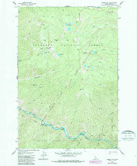
1978 Map of Sheep Hill
USGS Topo · Published 1987About this map
The Salmon River carves a deep canyon through this central Idaho wilderness, serving as the primary geographic corridor between the Nez Perce National Forest and the Payette National Forest. This 1978 edition illustrates the remote terrain within the Frank Church River of No Return Wilderness, where access is limited to a network of a Pack Trail routes. Along the river, several bars including Bear Bar and Nixon Bar indicate depositional points once vital for travel or seasonal activity. Notable landmarks such as Sheep Hill and its associated Lookout provide vantage points over a landscape of alpine lakes and dramatic ridges. The presence of Barth Hot Springs and Bruin Creek Campground highlights the area's role as a destination for back-country recreation and river navigation, specifically near the challenging Hancock Rapids.
Find a feature on this map
50 named features on this map. Tap any name to fly to it.
Don’t see what you’re looking for? This feature index may not catch every label — zoom into the map to look around manually.
Map Details
Editions of this 1978 Sheep Hill Map
2 editions found
Other maps of this area

1956 · Elk City
USGS Topo · 1:250,000

1960 · Elk City
USGS Topo · 1:250,000

1974 · Meadow Of Doubt
USGS Topo · 1:24,000

1977 · Boston Mtn
USGS Topo · 1:24,000

1978 · Arctic Point
USGS Topo · 1:24,000

1978 · Spread Creek Point
USGS Topo · 1:24,000

1978 · Dennis Mtn
USGS Topo · 1:24,000

1978 · Hida Point
USGS Topo · 1:24,000

1978 · Sheep Hill
USGS Topo · 1:24,000

1978 · Devils Teeth Rapids
USGS Topo · 1:24,000