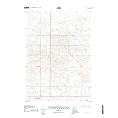
2017 Map of Sheep Mountain
USGS Topo · Published 2017About this map
Sheep Mtn and Tatman Mtn dominate this portion of Big Horn County, defining a landscape shaped by significant topographic relief and a network of seasonal drainages. The map reveals the intricate management of water in this arid environment through features like the Saint Joe Canal and man-made catchments such as Neves Reservoir and Dobson Pond. These developments indicate the essential role of irrigation and water storage for supporting life and land use in the Big Horn Basin. Numerous named watercourses, including Dry Cottonwood Cr and Rock Waterhole Cr, carve through the terrain, illustrating the natural drainage patterns that have dictated local ranching and transit routes for generations. This 2017 survey by the U.S. Geological Survey provides a precise view of the physical geography and public land survey system grid across townships like T50N R97W.
Find a feature on this map
17 named features on this map. Tap any name to fly to it.
Don’t see what you’re looking for? This feature index may not catch every label — zoom into the map to look around manually.
Map Details
Editions of this 2017 Sheep Mountain Map
This is the sole edition of this map. No revisions or reprints were ever made.
Other maps of this area

1951 · Burlington
USGS Topo · 1:24,000

1951 · Sucker Dam
USGS Topo · 1:24,000

1951 · Y U Bench NE
USGS Topo · 1:24,000

1951 · Sheep Mountain
USGS Topo · 1:24,000

1951 · Tatman Mountain
USGS Topo · 1:24,000

1951 · Wardel Reservoir
USGS Topo · 1:24,000

1951 · Otto
USGS Topo · 1:24,000

1951 · Dead Indian Hill
USGS Topo · 1:24,000

1951 · Dutch Nick Flat NW
USGS Topo · 1:24,000

1955 · Cody
USGS Topo · 1:250,000