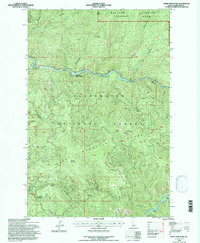
1994 Map of Sheep Mountain
USGS Topo · Published 1997About this map
The North Fork Clearwater River carves a deep path through this portion of the Clearwater National Forest, defining the region's transport and utility corridors. The map records a landscape managed for both timber and monitoring, anchored by the Canyon Work Center and specialized technical installations like the Aquarius Gaging Station Electronic Site. High elevations are dominated by the Sheep Mountain Range, where peaks such as Sheep Mountain and Preceptor Point overlook a dense network of drainages including Isabella Creek and Lost Creek. Strategic survey points are established at the Eagle Point Lookout Electronic Site, while natural passes like Swanson Saddle and June Saddle indicate the traditional routes through the high country. To the north, the Mallard Pioneer Larkins Area marks a transition into more primitive territory, characterized by ridges like West Sister and the headwaters of Fern Creek.
Find a feature on this map
35 named features on this map. Tap any name to fly to it.
Don’t see what you’re looking for? This feature index may not catch every label — zoom into the map to look around manually.
Map Details
Editions of this 1994 Sheep Mountain Map
This is the sole edition of this map. No revisions or reprints were ever made.
Other maps of this area

1911 · Lolo
USGS Topo · 1:250,000

1913 · Lolo
USGS Topo · 1:250,000

1923 · Washington Creek
USGS Topo · 1:125,000

1956 · Hamilton
USGS Topo · 1:250,000

1959 · Hamilton
USGS Topo · 1:250,000

1960 · Hamilton
USGS Topo · 1:250,000
1963 · Mallard Peak
USGS Topo · 1:24,000

1963 · Sheep Mtn
USGS Topo · 1:24,000
1963 · Buzzard Roost
USGS Topo · 1:24,000
1963 · Pole Mtn
USGS Topo · 1:24,000