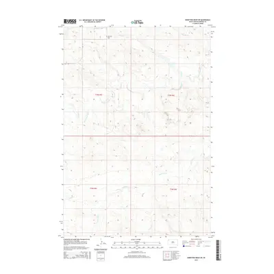
2015 Map of Sheep Pen Draw SW
USGS Topo · Published 2015About this map
Old Grand River Cem sits near the northern boundary of this Harding County landscape, a vital point of interest for genealogists tracing early families in the northwestern South Dakota plains. The terrain is defined by an intricate network of drainage systems, most notably the meandering S Fork Grand River which carves through the central portion of the sheet. This river is fed by numerous tributaries including Clarks Fork Cr, Sheep Cr, and Boxelder Cr, illustrating the hydrological patterns of the western Great Plains. Transportation in this section of the county is minimal, primarily represented by Lyons Rd, highlighting the enduring isolation and agricultural character of the region. The map provides a precise look at the township and range divisions, such as t19n r5e and t18n r6e, which governed land settlement in this cattle and sheep ranching country.
Find a feature on this map
12 named features on this map. Tap any name to fly to it.
Don’t see what you’re looking for? This feature index may not catch every label — zoom into the map to look around manually.
Map Details
Editions of this 2015 Sheep Pen Draw SW Map
This is the sole edition of this map. No revisions or reprints were ever made.
Other maps of this area

1935 · Reva
USGS Topo · 1:125,000

1935 · Hoover
USGS Topo · 1:125,000

1935 · Harding
USGS Topo · 1:125,000

1935 · Buffalo
USGS Topo · 1:125,000

1954 · Lemmon
USGS Topo · 1:250,000

1957 · Lemmon
USGS Topo · 1:250,000

1971 · Buffalo
USGS Topo · 1:24,000
1971 · Sheep Pen Draw
USGS Topo · 1:24,000

1971 · McKenzie Butte
USGS Topo · 1:24,000
1971 · Sheep Pen Draw SW
USGS Topo · 1:24,000