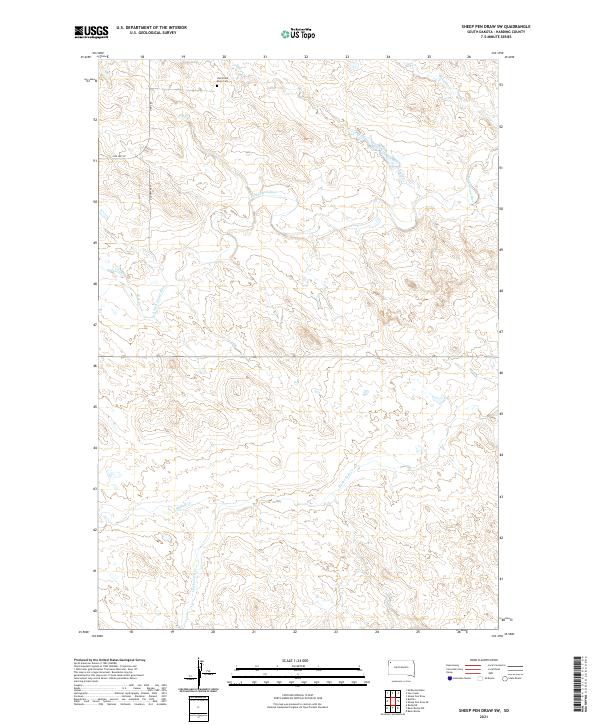
2021 Map of Sheep Pen Draw SW
USGS Topo · Published 2021About this map
The Old Grand River Cem sits near the northern boundary of this Harding County landscape, marking a site of genealogical interest in a terrain defined by the complex drainage of the S Fork Grand River. The topography is etched by numerous watercourses, including the winding Clarks Fork Cr and Buffalo Cr, which flow through the southern townships. Transport patterns are reflected in the presence of Old Hwy 85 and Old Hwy 58 N, indicating earlier arterial routes that once served the rural community. The map illustrates a remote prairie environment where the network of seasonal creeks like Slick Cr and Boxelder Cr dictates the local geography, providing a clear record of land use and natural boundaries in this corner of South Dakota.
Find a feature on this map
15 named features on this map. Tap any name to fly to it.
Don’t see what you’re looking for? This feature index may not catch every label — zoom into the map to look around manually.
Map Details
Editions of this 2021 Sheep Pen Draw SW Map
This is the sole edition of this map. No revisions or reprints were ever made.
Other maps of this area

1935 · Reva
USGS Topo · 1:125,000

1935 · Hoover
USGS Topo · 1:125,000

1935 · Harding
USGS Topo · 1:125,000

1935 · Buffalo
USGS Topo · 1:125,000

1954 · Lemmon
USGS Topo · 1:250,000

1957 · Lemmon
USGS Topo · 1:250,000

1971 · Buffalo
USGS Topo · 1:24,000
1971 · Sheep Pen Draw
USGS Topo · 1:24,000

1971 · McKenzie Butte
USGS Topo · 1:24,000
1971 · Sheep Pen Draw SW
USGS Topo · 1:24,000