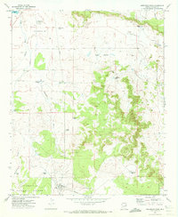
1971 Map of Sheepskin Wash
USGS Topo · Published 1973About this map
Sitgreaves National Forest anchors the southern portion of this Navajo County landscape, where the high desert terrain is defined by an intricate network of drainages and seasonal water catchments. The northern reaches are characterized by the prominent Pink Cliffs and broad depressions, including the notable Dry Lake. In an arid environment where water management was essential for ranching and industry, the map reveals a system of tanks and windmills, such as Morris Windmill and Rattlesnake Tank. Industrial activity is evidenced by a Pulp Mill and a Pipeline that traverses the terrain near Sheepskin Wash. The presence of the Rocking Chair Ranch in the east, along with residential markers like Carson Drive and Louise Dr, illustrates the localized patterns of settlement and land use during the early 1970s.
Find a feature on this map
35 named features on this map. Tap any name to fly to it.
Don’t see what you’re looking for? This feature index may not catch every label — zoom into the map to look around manually.
Map Details
Editions of this 1971 Sheepskin Wash Map
This is the sole edition of this map. No revisions or reprints were ever made.
Other maps of this area

1886 · Holbrook
USGS Topo · 1:250,000

1893 · Holbrook
USGS Topo · 1:250,000

1954 · Holbrook
USGS Topo · 1:250,000

1957 · Holbrook
USGS Topo · 1:250,000

1958 · Holbrook
USGS Topo · 1:250,000

1960 · Holbrook
USGS Topo · 1:250,000

1961 · Clay Springs
USGS Topo · 1:62,500
1970 · Cactus Flat
USGS Topo · 1:24,000
1970 · Second Knolls
USGS Topo · 1:24,000
1970 · Flattop Hill
USGS Topo · 1:24,000